A busy day on the isthmus of Cape Matapan could consist of making a loop to go to Kokkinogia (Κοκκινόγεια) then to Cape Matapan, enjoy the beach of Marmari (Μαρμάρι), then dine with your feet in the water of Porto Kagio (Πόρτο Κάγιο). Or in another order. The best paths to get to/from these three places on foot meet at the church of Agia Triada (Αγία Τριάδα, “Holy Trinity”, the well-named), in the north of the peninsula. The terrain is mountainous but with limited differences of elevation. The descent from Mianes is done on a stony, intermittent path, but does not present any real difficulty.
➀ Porto Kagio – Agia Triada : 20 – 30 min. Go up the road, and after 4 bends, take the small road on the left which goes to the cemetery which dominates the village. Then follow the path which leads you easily to the church of Agia Triada.
➁ Marmari – Agia Triada : 15 min. Climb the semblance of a staircase that rises towards the mountain in the middle of the village, it joins a path that you follow to the left. To avoid the rickety staircase, you can also take the path a little higher in the village. The almost flat path (which is rare in the area !) follows the side of the hill until it reaches a road which gets to the church of Agia Triada.
➂ Agia Triada – Cape Matapan via Mianes : 2 h
Longer option by the mountain, to enjoy the splendid panorama of Cape Matapan and the surroundings.
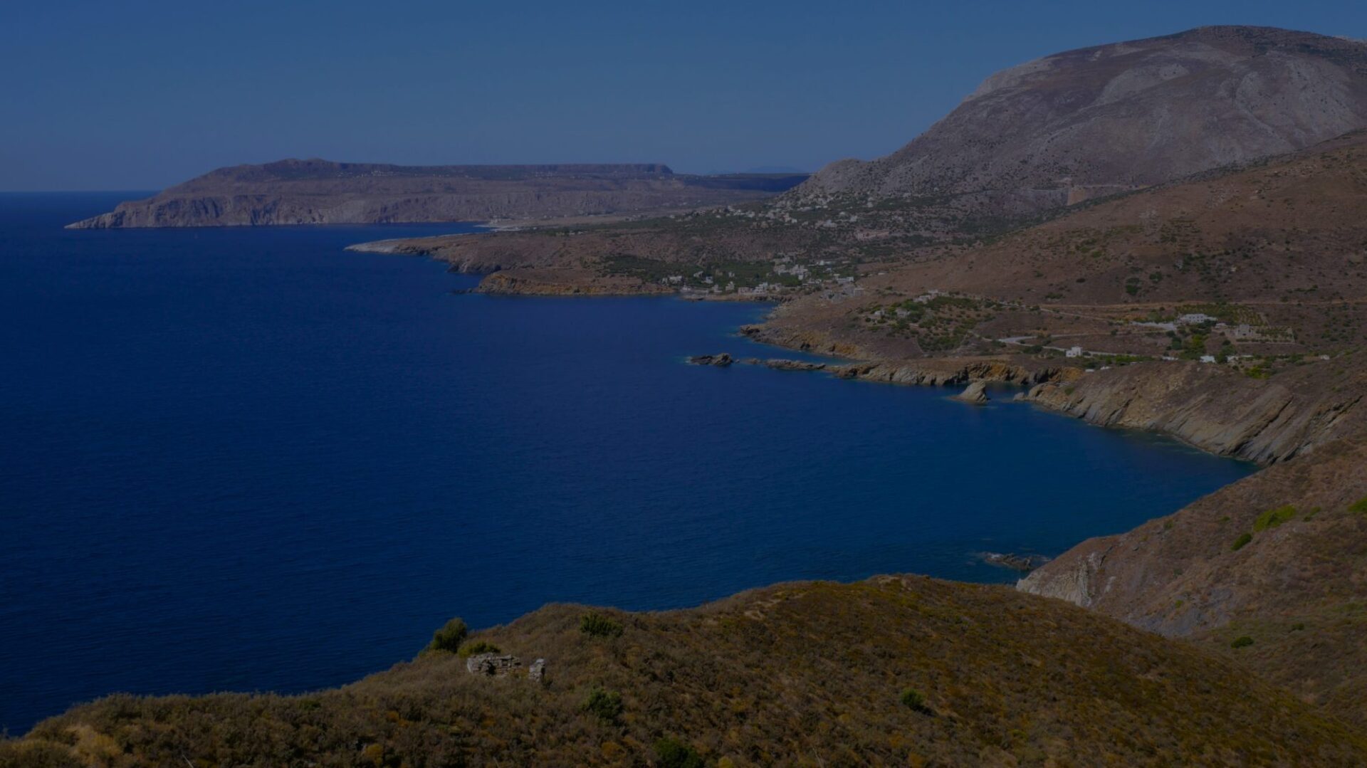
At Agia Triada, take the road that goes up and heads south. 300 m further on, at the crossroads, turn right towards Cape Matapan. 100 m further, turn right on the small road which rises, towards Mianes (Μιανές). Majestic views over the east of the peninsula, with the Epidaurus Limira peninsula and the island of Kythera in the background. 1.5 km further on, the small road branches off to the right, rising towards the hamlet of Mianes: rather continue straight on the track which leads you to the remains of the village of Agriokambi (Αγριοκάμπι). Go around the ruins by the right, until you have the line of sight of the ridge of Cape Matapan, due south. On the southern slope, a path can be guessed on the left side. It allows you to descend fairly steadily. If you lose it, continue due south. At mid-slope, the path appears more clearly going to the right in a straight way. It seems to throw itself into the gully, but just before it turns to the left to finish descending parallel to it. The trail turns slowly from south to east. About 200 m after the path has forked to the left to follow the ravine, follow the path supported by a low wall that heads south. It allows you to quickly reach the shore and the road to Cape Matapan. Kokkinogia is 5 mins on the left, Cape Matapan 30 mins on the right.
➃ Agia Triada – Cape Matapan via Kokkinogia : 1 h 15
Fast option by road.
At Agia Triada, take the road that goes up and heads south. 300 m further on, at the crossroads, turn right towards Cape Matapan. 100 m further, continue straight and follow the road. You get to Kokkinogia after 2 km. Then follow the signs that lead you to the Cape Matapan trail.