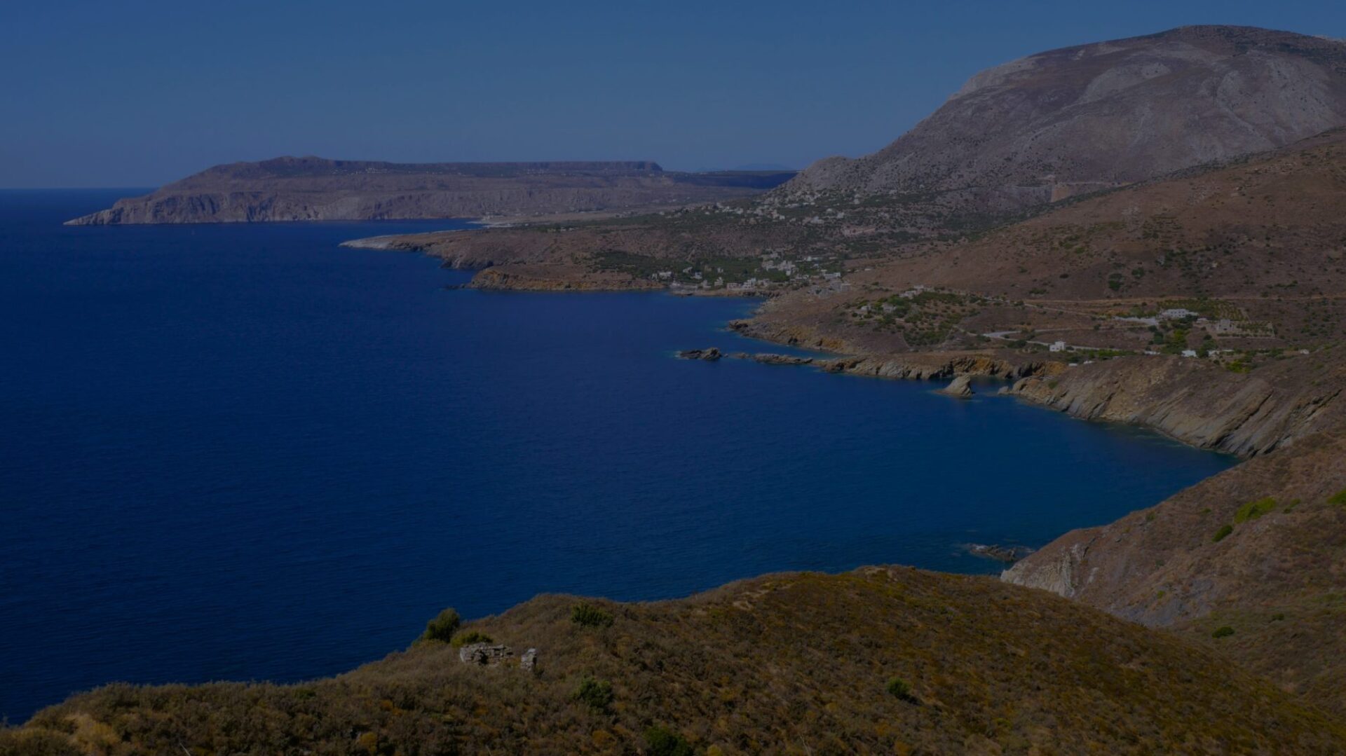
This hike takes you from Oitylo (Οίτυλο) (pronounced “Itilo”) to Pyrgos Dirou (Πύργος Διρού) in around 4.5 hours. It first descends to the foot of the village of Oitylo, then goes up towards the small town of Areopoli, offering beautiful panoramas. The second part is wilder, it takes in particular an old paved path that you sometimes have to look for in the middle of the vegetation. We spend a lot of time going up and down, which makes it a somewhat sporty hike.
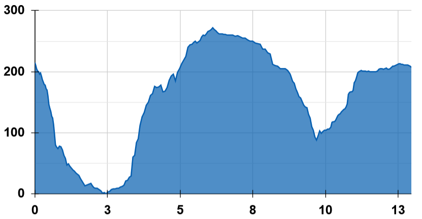
Distance : 12.9 km
Durée : 4 h 30
Altitude max : 272 m
Dénivelé + : 405 m
Dénivelé – : 410 m
Intérêt : 3/5
Difficulté : 3/5
| 12.9 km | 4 h 30 | 272 m | 405 m | 410 m |  |
➀ Several streets of Oitylo (Οίτυλο) lead, on the west side, to paths that go down on the sides of the mountain. Choose one. Do not miss the Church of the Savior (Sotira, Σοτηρα) just below the village. The path arrives on a track, which on the right goes towards the Monastery of Dekoulou (Μονή Ντεκουλών). Go left. Follow the track for 300 m, then take the path that goes down on the right. 700 m further, you end up on the main road Kalamata – Areopoli. Carefully follow it for 600 m, and turn right towards Neo Oitylo.
➁ Neo Oitylo (Νέο Οίτυλο), 45 min from Oitylo. Several restaurants, a grocery store.
Cross the village then return to the main road. Take the path that climbs the hill just after the house on the right-hand bend following the village. This magnificent stony path progresses along the side of the hill, dominating first the bay of Neo Oitylo, then that of Limeni. After 2.5 km, the path joins the Kalamata – Areopoli road. Take a left, then a quick right to cross the next bend. You return to the main road, cross it and follow the path that rises opposite. You quickly arrive on another road. On your left, a gas station: turn right, the sidewalk will take you to the center of Areopoli.
➂ Areopoli (Αρεόπολη), 1 h 30 from Neo Oitylo. Many solutions for accommodation, restaurants, grocery stores, various shops. A priori a good stopover for a night.
One block west of the main square, take the street that goes south. It quickly turns into a track. When it takes a bend to the left, take the path that heads off to the right, winding between two dry stone walls. You leave on the left the chapel dedicated to the Holy Savior (Agios Sozon, Άγιος Σώζων). The track goes down gradually, offering a beautiful view of the bay of Dirou. It passes through an open gate, then turns into a path.
From here, you have to carefully follow the path, especially the old but still robust paved path, and only turn away a few meters when it is devoured by the maquis. You are on what the locals call the “Mani Avenue”, the artery that linked the north of Mani to Gerolimenas, which is in a very sad state today. Thorns abound, so please cover your legs if you can. The path crosses a river below by a small stone bridge that is worth a look.
Going up the opposite hill, you get to a place called Xepapadianika (Ξεπαπαδιάνικα), from where you find a road that leads you in a series of short bends to the sleepy village of Xaria (Χαριά). At the entrance to the village, the shade of the oak in the church square invites you to take a break after this short but steep ascent. Cross Xaria, take the small road which leads you to Lefkias (Λευκιας) then to Pyrgos Dirou.
➃ Pyrgos Dirou (Πύργος Διρού), 2 h from Areopoli.