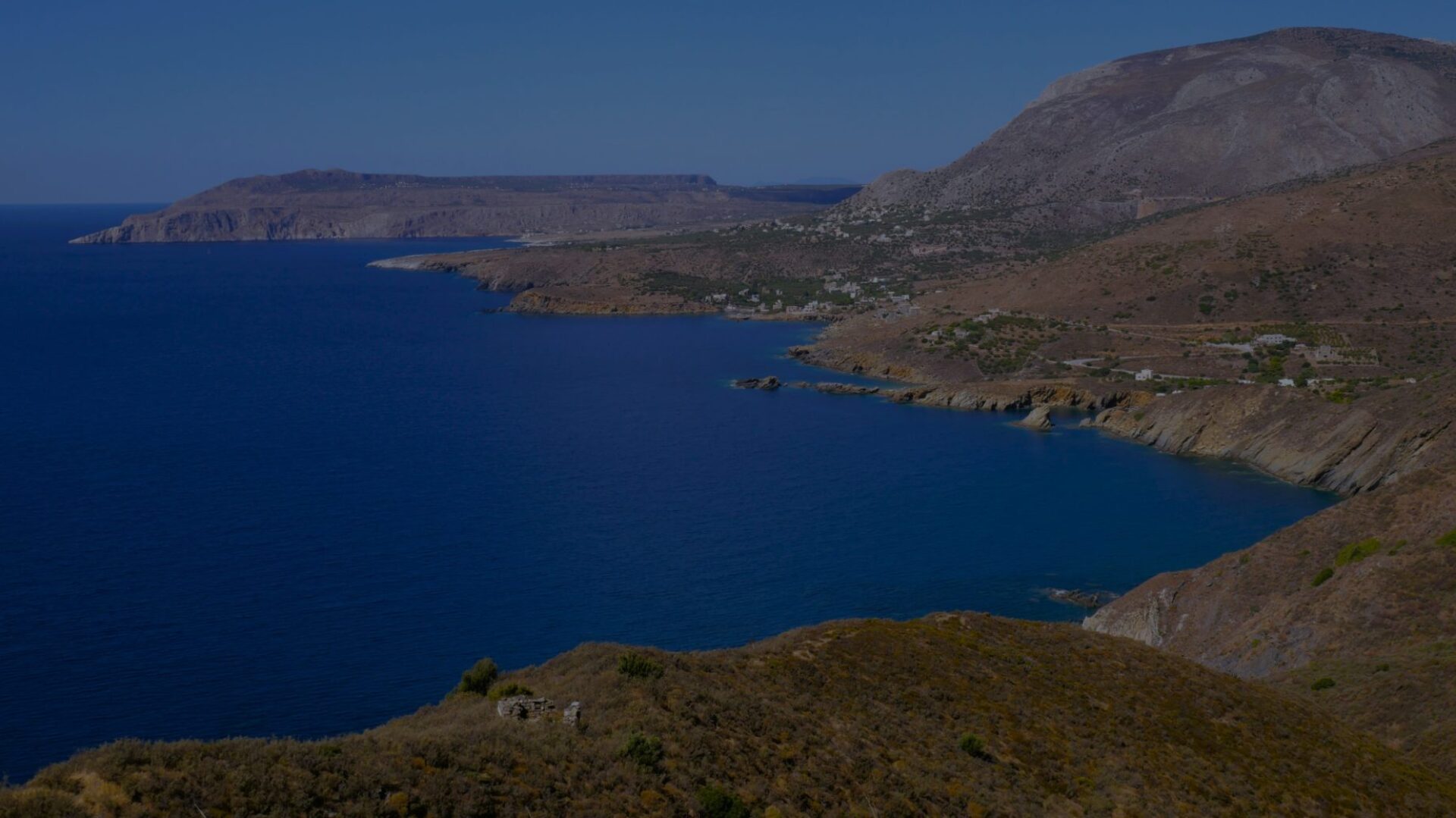
This hike takes you from Pyrgos Dirou (Πύργος Διρού) to Gerolimenas (Γερολιμένας, pronounced “Yerolimenas”) in about 6 hours. It offers beautiful views of the Mani mountains and passes through many picturesque villages including Vamvaka, Mina, Nomia and Kechrianika. Beautiful perspectives also on the bay of Mezapos and Cape Tigani. The hike is relatively long but not very physically demanding, the elevation gain being quite limited.
Distance : 23 km
Durée : 6 h
Altitude max : 282 m
Dénivelé + : 200 m
Dénivelé – : 400 m
Intérêt : 3/5
Difficulté : 3/5
| 23 km | 6 h | 282 m | 200 m | 400 m |  |

➀ Leave Pyrgos Dirou (Πύργος Διρού) heading towards its “castle” (Πύργος Σκλαβουνάκου) to the south of the village, identifiable by a high tower characteristic of the region. Go in front of the castle, taking the time to take a look at it from the street (it is closed to visitors), then continue on this track. At the end of the track, on your right, another typical old Maniate property. The track ending here, continue straight on a path that leads you to the hamlet of Nikandrio (Νικάνδρειο). In Nikandrio, take the road on the left, then after 200 m, continue straight due east on the track which goes on the left side. Cross the small road that you reach and continue on the path that goes opposite. Pass the main Aréopoli – Gerolimenas road, continue opposite on the path that rises towards the mountain.
Then take the first right which seems to serve a house. Pass in front of the house and continue on this road parallel to the main road. It quickly turns into a track for about 2 kilometers, then back into a paved road after passing the small church dedicated to Saint Peter (Άγιος Πέτρος). It allows both to cross picturesque villages dominated by a few Maniote towers, and to benefit from a splendid panorama on the bays which follow one another, overhung by imposing cliffs. These villages are rich in adorable Byzantine churches, sometimes ten centuries old, but which are most often closed to better preserve them.
➁ Among these villages, Vamvaka (Βαμβακά), 1h45 from Pyrgos Dirou, seems to be the most important. There is a tavern at the entrance to the village, and in front of the church a square with three benches and a pretty view.
➂ Then you arrive at Mina (Μίνα), 45 min from Vamvaka. The benches outside the church also lend themselves to taking a break. No tavern nor any cafe apparently.
Cross the village to reach the small road that leads you to the cemetery and the church dedicated to Saint Solomone (Αγίας Σολωμονής). Go along the cemetery on the right, and continue straight on along a track which offers a magnificent view of the plain strewed with towers and the bay of Mazapos.
The track takes you to the main road, which you go up to the north for 250 m before turning left. 300 m further to the north, at the edge of the main road, is a snack bar, if you want a comfortable break. So, a few hundred meters after turning left, you get to a place called Kato Gardenitsa (κάτω γαρδενίτσα), and you discover on your left the site of an old mill, then a small church (Ιερός Ναός του Σωτήρα, “Sotira”, Holy Church of the Savior).
Here begins a succession of paths in the middle of the olive trees, sometimes intersected by small roads, which lead you to the village of Nomia. The main intersections are marked with signposts for hikers. Between the signposts … you weave through the maze of trails following the south/southwest direction.
➃ Nomia (Νόμια), 1h45 from Mina. No tavern apparently.
To the south of the village, you reach the church of “Panagias” (Παναγία, Saint Mary), which you bypass to the left. A path surrounded by two dry stone walls heads south, but it is impassable because it is overgrown. It is then necessary to follow the trail which winds parallel to the path through the dense vegetation. After about 800 m, you find a track still oriented towards the south, then you take the first track on the left towards the village of Kechrianika (Kεχριάνικα). Arrived in the middle of the village, a sign for hikers indicates the path to take in the middle of the houses often in ruins. You then get on a small road, opposite the pretty little church of Saint Charalambos (Aγιος Χαράλαμπος). Turn right, then take the first road on the left, heading south. After a cemetery, you pass a few houses, this is the village of Neasa (Νέασα). Shortly after, you come to a crossroads. Turn left, and let this road take you to Gerolimenas.
➄ Gerolimenas (Γερολιμένας), 1h45 from Nomia.