This hike takes you from Stoupa (Στούπα) to Agios Nikon (Άγιος Νικών) in around 4.5 hours. It runs along the coast all along the route, first at the water’s edge, stopping in several picturesque ports (Agios Nikolaos, Agios Dimitrios, Trachila) then climbing on the cliff where the village of Agios Nikon is nestled. The hike is mostly easy, until the ascent of the cliff between Trachila and Agios Nikon which can be compared to a mountain hike. To continue after Agios Nikon, it is necessary to favor for a few kilometers hitchhiking or taxi (no bus after Agios Nikon on the date of my hike).
Distance : 16.3 km
Durée : 4 h 30
Altitude max : 387 m
Dénivelé + : 630 m
Dénivelé – : 250 m
Intérêt : 4/5
Difficulté : 3/5
| 16.3 km | 4 h 30 | 387 m | 630 m | 250 m |  |

➀ Exit Stoupa (Στούπα) by the small road that heads south. It crosses an olive grove, then reaches the coast. Walk along the coast, take the road to the right at the corner of a large gray cut stone building. The road turns into a cycle and pedestrian path, which takes you directly to the village of Agios Nikolaos.
➁ Agios Nikolaos (Άγιος Νικόλαος), 45 min from Stoupa. You will easily find refreshments or something to eat in this pleasant village where the activity is concentrated around its small port. Follow the road along the coast to the next village, Agios Dimitrios (Άγιος Δημήτριος), located 2.5 km further on.
➂ Agios Dimitrios (Άγιος Δημήτριος), 30 min from Agios Nikolaos.
Head to the adorable little port of Agios Dimitrios. Walk along the bay by the beach, then get to the road bypassing the church. Then continue to follow the coast by the road which leads to the village of Trachila, at the foot of the cliff.
➃ Trachila (Τραχήλα), 1 h from Agios Dimitrios.The isolation of this village, at the end of the road, gives it a certain charm and calm. There are 2 restaurants, open at least seasonally.
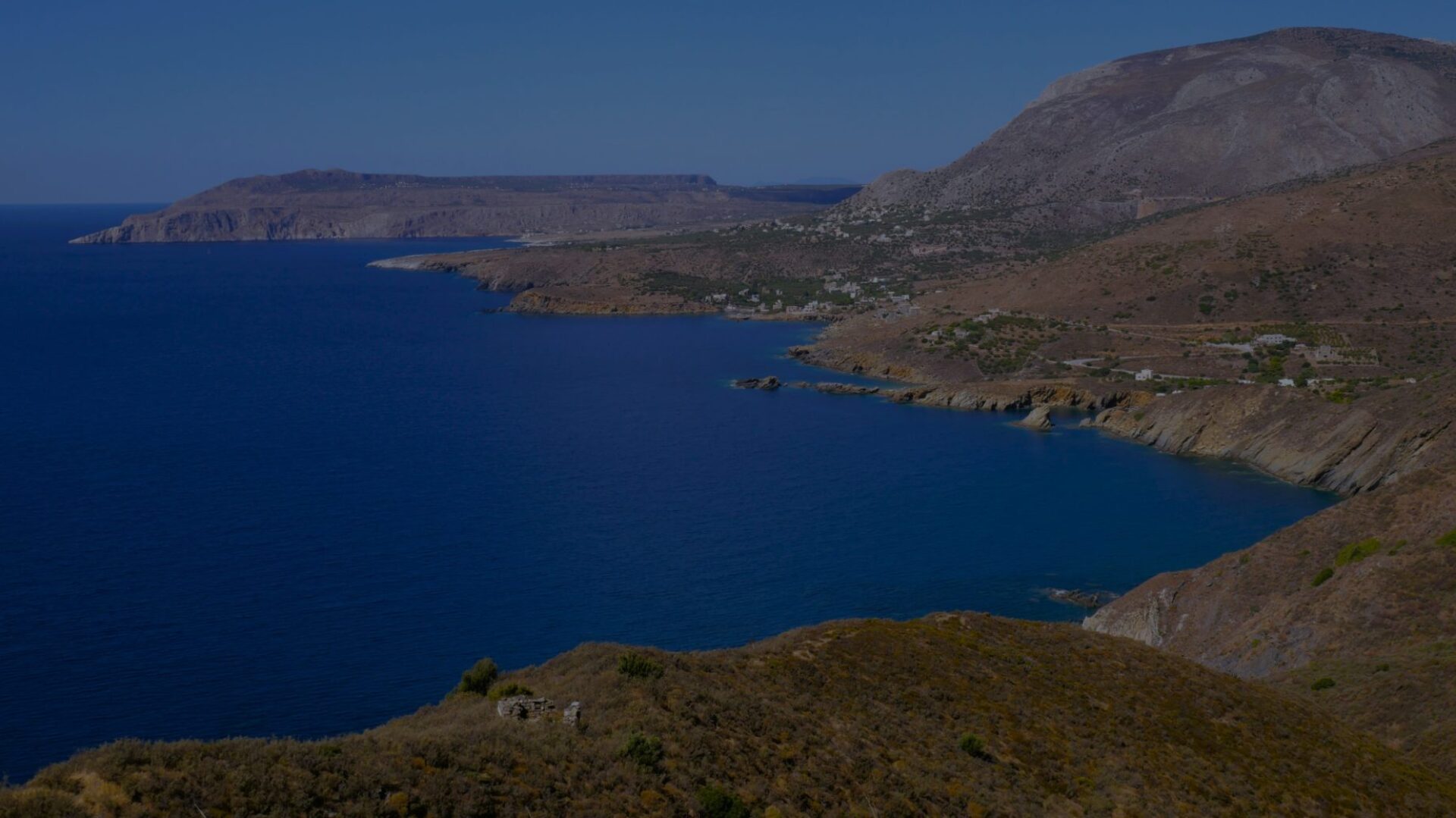
Continue on the road which becomes a track. After 1 km, the track comes up against a creek and branches off to the left. Follow it, cross the bed of the stream (usually dry) which flows into the creek for a few tens of meters, and climb on the opposite side, trying to locate the track. After a hundred meters, a clear path stands out. Follow it, 4 switchbacks are enough to project you 200 m higher than the creek bed, after 1.7 km of climbing. Between the 3rd and 4th bend, you pass some ruins which correspond to the place called Smouga (Σμούγα). The path then turns south. The ascent continues but is more gentle, with 150 m more in 2 km to Agios Nikon. Enjoy the view !
➄ Agios Nikon (Άγιος Νικών), 1h45 from Trachila. A cafe in the main square.
Continuing south after Agios Nikon is a little more complicated: you have to take the main road for several kilometers (until Oitylo), because there is no network of tracks, paths or small roads to continue . The road is often narrow and relatively busy, with sometimes limited visibility: it is therefore unwise to take it on foot for such a long distance.
Bad luck, this part of the route coincides with the border between Messenia and Laconia. At the time of writing, KTEL Messinias buses arriving from Kalamata have Agios Nikon as their terminus (even if they sometimes display Oitylo as their final destination, which does not correspond to reality), and buses from KTEL Lakonias do not serve Agios Nikon or even Oitylo, they start from Aeropoli. In other words, there are no buses on this part of the route.
Fallback solutions: hitchhiking, taxi, and of course find out about buses, you never know.